
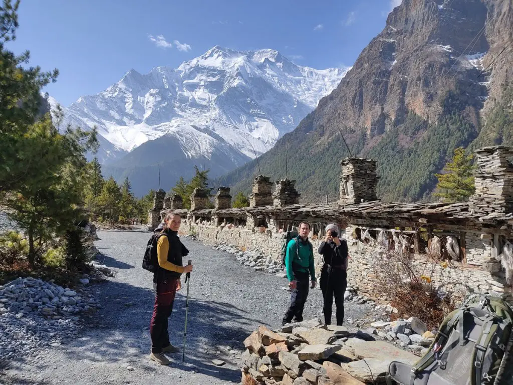
Trip Overview
The Annapurna Circuit Trek is widely celebrated as one of the world's premier long-distance mountain journeys. Encircling the massive Annapurna Massif, this 15-day itinerary transitions through subtropical pine forests, terraced agricultural river valleys, and high-altitude Himalayan deserts.
The absolute highlight of the journey is crossing Thorong La Pass (5,416m / 17,769ft), one of the highest navigable trekking passes on Earth. Along the way, trekkers pass sacred pilgrimage sites like Muktinath, navigate the Kali Gandaki Gorge (the deepest gorge in the world), and experience the distinct cultures of the Gurung, Manangba, and Thakali ethnic communities.
Fast Facts
|
Parameter |
Details |
|---|---|
|
Max Elevation |
5,416m / 17,769ft (Thorong La Pass) |
|
Trek Duration |
15 Days (Kathmandu to Kathmandu) |
|
Difficulty Level |
Moderate to Challenging |
|
Best Seasons |
Spring (March – May) & Autumn (September – November) |
|
Required Permits |
ACAP (Annapurna Conservation Area Permit) & TIMS Card |
|
Accommodation |
Teahouses / Mountain Lodges |
|
Starting Point |
Dharapani / Besisahar |
|
Ending Point |
Jomsom / Pokhara |
Key Highlights
- Cross Thorong La Pass (5,416m): Reach the peak altitude of the trek with views across the Tibetan Plateau.
- Panoramic Mountain Views: Stand face-to-face with Annapurna I (8,091m), Dhaulagiri (8,167m), Machhapuchhre (Fishtail), Annapurna II, III, IV, and Gangapurna.
- Cultural Diversity: Discover ancient Buddhist monasteries, prayer wheels, and traditional villages of the Manangba and Thakali peoples.
- Muktinath Temple: Visit the sacred site venerated by both Hindus and Buddhists.
- Deepest River Gorge: Trek alongside the Kali Gandaki River cutting between two 8,000-meter giants (Annapurna & Dhaulagiri).
Detailed 15-Day Itinerary
Day 1: Arrival in Kathmandu
- Max Altitude: 1,400m / 4,593ft
- Activity: Arrival, briefing, and equipment check
Upon arrival at Tribhuvan International Airport (KTM), transfer to your hotel in Thamel. In the afternoon, meet your lead guide for a detailed trek orientation, safety overview, and permit verification. Spend the evening acquiring any missing gear in Thamel’s gear shops.
Day 2: Kathmandu to Dharapani via Besisahar (Drive)
- Max Altitude: 1,860m / 6,102ft
- Drive Duration: 8 – 10 hours
- Distance: ~210 km
Drive early morning along the Trishuli and Marsyangdi rivers on the Prithvi Highway. Reaching Besisahar, switch to a local 4WD vehicle to reach Dharapani. Driving directly to Dharapani avoids walking on the dusty off-road vehicle track between Besisahar and Jagat.
Day 3: Dharapani to Chame
- Max Altitude: 2,670m / 8,760ft
- Trek Duration: 5 – 6 hours
- Distance: ~15.5 km
The trekking officially begins. Ascend through pine, fir, and oak forests while listening to the roar of the Marsyangdi River. Pass through Bagarchhap and Timang, enjoying your first clear views of Lamjung Himal and Mount Manaslu. Arrive in Chame, the administrative hub of Manang District.
Day 4: Chame to Upper Pisang
- Max Altitude: 3,300m / 10,826ft
- Trek Duration: 5 – 6 hours
- Distance: ~13.5 km
Walk through dense pine forests and witness the dramatic, smooth rock wall known as Paungda Danda rising over 1,500m above the river. Continue towards Upper Pisang for superior views of Annapurna II and Pisang Peak, as well as an authentic high-altitude village feel.
Day 5: Upper Pisang to Manang (via Ghyaru & Ngwal)
- Max Altitude: 3,540m / 11,614ft
- Trek Duration: 6 – 7 hours
- Distance: ~19.5 km
Take the high scenic upper route via Ghyaru and Ngwal. While steeper, this trail provides unparalleled elevated views of the Annapurna Range and helps significantly with natural acclimatization ("climb high, sleep low"). Pass ancient stupas and prayer flags before descending to the broad valley of Manang.
Day 6: Acclimatization Day in Manang
- Max Altitude: 3,540m / 11,614ft (Rest Day)
- Activity: Side hikes to Ice Lake (4,600m) or Gangapurna Viewpoint (3,800m)
Essential rest day to prepare your body for higher elevations. Take an acclimatization hike to the Gangapurna Lake viewpoint or up to Praken Gompa for a blessing from a local monk. Alternatively, fit trekkers can tackle the full-day hike to Ice Lake (Kicho Tal - 4,600m).
Day 7: Manang to Yak Kharka
- Max Altitude: 4,020m / 13,188ft
- Trek Duration: 4 – 5 hours
- Distance: ~10.5 km
Leave the main valley and head north toward Thorong La. The landscape transforms into alpine scrub and sparse vegetation. Cross small wooden bridges and pass pastures where blue sheep (Bharal) and yaks graze. The short trekking hours allow for conservative elevation gain above 3,000 meters.
Day 8: Yak Kharka to Thorong Phedi or High Camp
- Max Altitude: 4,450m (Phedi) / 4,880m (High Camp)
- Trek Duration: 3 – 4 hours
- Distance: ~7.3 km
Trek steadily to the base of the pass at Thorong Phedi. Depending on weather, group fitness, and acclimatization levels, stay at Thorong Phedi (4,450m) or push an extra hour up the steep incline to Thorong High Camp (4,880m) to shorten tomorrow's pass crossing.
Day 9: Thorong Phedi/High Camp to Muktinath via Thorong La Pass
- Max Altitude: 5,416m / 17,769ft (Pass) | 3,760m / 12,336ft (Muktinath)
- Trek Duration: 8 – 10 hours
- Distance: ~16 km
Begin around 4:00 AM to avoid high midday winds at the pass. Climb steeply over icy or rocky switchbacks to reach Thorong La Pass (5,416m), marked by colorful prayer flags and a small teahouse. After celebrating and capturing photos, begin a steep 1,600-meter descent down to the sacred village of Muktinath.
Day 10: Muktinath to Jomsom via Jharkot & Kagbeni
- Max Altitude: 3,760m / 12,336ft
- Trek Duration: 5 – 6 hours
- Distance: ~18 km
Visit Muktinath Temple’s 108 water spouts in the morning before trekking down through the Mustang desert landscape. Pass the ancient Tibetan village of Jharkot and enter Kagbeni, the gateway to Upper Mustang. Continue along the windy Kali Gandaki riverbed, hunting for fossilized Shaligrams, until reaching Jomsom.
Day 11: Jomsom to Pokhara (Flight or Scenic Drive)
- Max Altitude: 2,715m (Jomsom) to 822m (Pokhara)
- Flight Time: 25 minutes (or 6–8 hour drive via Tatopani)
Take an early morning flight from Jomsom to Pokhara between the Annapurna and Dhaulagiri massifs. (Note: If flights are grounded due to weather, private 4WD transportation via Tatopani and Beni serves as the primary backup route). Spend the afternoon relaxing by Phewa Lake.
Day 12: Buffer / Exploration Day in Pokhara
- Max Altitude: 822m / 2,696ft
- Activity: Sightseeing, rest, and buffer day
Enjoy a free day in Pokhara. Explore Davis Falls, the World Peace Pagoda, Sarangkot, or take a boat across Phewa Lake. This day also acts as a critical buffer in case of flight delays out of Jomsom on Day 11.
Day 13: Pokhara to Kathmandu (Drive or Flight)
- Max Altitude: 1,400m / 4,593ft
- Drive Duration: 6 – 7 hours (or 25-minute flight)
- Distance: ~200 km
Drive back to Kathmandu along the Prithvi Highway. Upon arrival, check in to your hotel and spend the evening enjoying a farewell dinner featuring traditional Nepalese cultural dance performance.
Day 14: Kathmandu Sightseeing & Shopping
- Max Altitude: 1,400m / 4,593ft
- Activity: UNESCO World Heritage Site Tour
Explore Kathmandu’s iconic UNESCO sites: Pashupatinath Temple, Boudhanath Stupa, Swayambhunath (Monkey Temple), and Patan Durbar Square. Do last-minute souvenir shopping in Thamel.
Day 15: Final Departure
- Activity: Airport Transfer
Enjoy breakfast at your hotel. Transfer to Tribhuvan International Airport (KTM) 3 hours prior to your scheduled flight home.
Comprehensive Inclusions & Exclusions
What is Included:
- Transfers: All airport pick-ups and drop-offs via private vehicle.
- Transportation: Kathmandu–Dharapani (Land Cruiser/Jeep), Jomsom–Pokhara flight/drive, Pokhara–Kathmandu drive.
- Accommodation: 3 nights in Kathmandu & 2 nights in Pokhara (3-star hotel with breakfast); 9 nights in comfortable mountain teahouses during the trek.
- Meals: Full board (Breakfast, Lunch, Dinner) during the trekking days.
- Permits: ACAP (Annapurna Conservation Area Permit) & TIMS (Trekkers' Information Management System) cards.
- Staff: Government-licensed Himalayan Trekking Guide and Porters (1 porter for every 2 trekkers, max weight 18kg).
- Safety: Comprehensive first aid kit, pulse oximeter for daily oxygen level monitoring.
What is Excluded:
- International airfare and Nepal entry visa fees ($50 USD for 30 days).
- Travel & Medical Insurance (must cover emergency high-altitude helicopter evacuation up to 6,000m).
- Personal expenses (bar bills, laundry, hot showers, device charging, Wi-Fi in teahouses).
- Personal trekking gear (down jacket, sleeping bag, trekking poles).
- Tips for guide, driver, and porters (customary at the end of the trek).
Frequently Asked Questions (FAQs)
How difficult is the Annapurna Circuit Trek?
It is rated moderate to challenging. No technical climbing skills are required, but you should be capable of walking 5 to 7 hours daily over steep, uneven mountain terrain with a daypack.
How do I prevent Altitude Sickness (AMS)?
Follow these key safety rules:
- Walk at a slow, steady pace ("Bistari, bistari").
- Stay hydrated (drink 3–4 liters of water daily).
- Strictly honor the acclimatization day in Manang (Day 6).
- Consider taking Acetazolamide (Diamox) under medical consultation.
What is the best time of year to trek?
The ideal windows are Spring (March to May) for blooming rhododendrons and warm weather, and Autumn (September to November) for clear blue skies and stable mountain conditions.